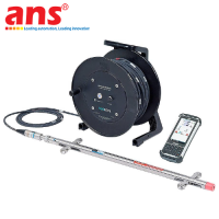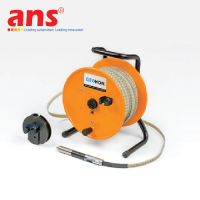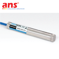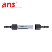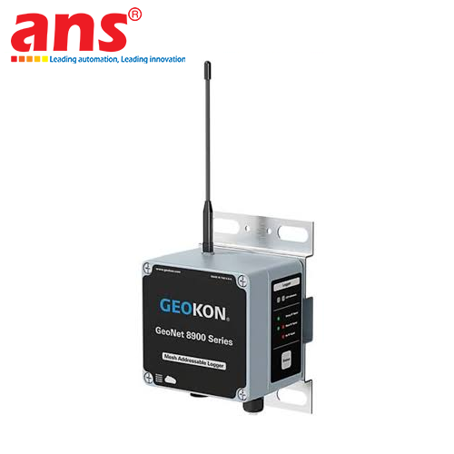
GEOKON GK-604D-150M Digital Inclinometer System (150m Cable, Bluetooth Reel, MEMS Probe)
Price: Contact
Brand: Geokon Vietnam
Category: Thiết bị quan trắc
Supplier: AnhNghiSon
Origin: USA


 0911472255
The GEOKON Model GK-604D-150M Turnkey Digital Inclinometer System (with Probe, Readout, 150m Cable, Reel & Pulley), engineered and manufactured by GEOKON, INC. in Lebanon, New Hampshire, USA, is an industry-benchmark geotechnical instrumentation platform designed for high-resolution lateral displacement profiling in deep excavations, slopes, embankments, and heavy civil structures.
Operating Principle & Complete GK-604D-150M System Topology:
The inclinometer system operates by traversing a wheeled sensor probe through internal guide grooves of grooved inclinometer casing installed vertically within boreholes or cast directly into structural elements. As ground deformation bends the casing, internal MEMS tilt accelerometers measure inclination at discrete 0.5-meter depth intervals to generate a cumulative horizontal deflection profile:
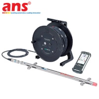
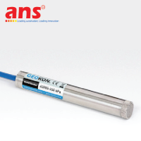
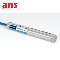
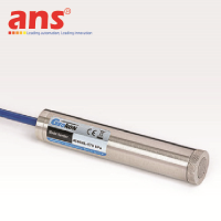
1. Model 6100D Digital Inclinometer Probe: Machined from heavy-gauge passivated stainless steel, housing two orthogonal low-noise MEMS accelerometers (Axis A: along wheel plane; Axis B: cross-plane). Onboard electronics convert analog sensor signals into a 24-bit digital data stream directly at the sensor head, eliminating signal attenuation and electrical noise across the 150-meter cable. An integrated anisotropic magneto-resistive digital compass measures casing groove spiraling (Spiral Survey) to mathematically correct deflection vectors.
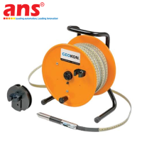
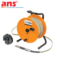
2. Model GK-604D-2 Bluetooth-Enabled Cable Reel: Ergonomic mechanical winding reel integrating an internal communication transceiver and a high-capacity rechargeable Lithium-Ion battery pack (> 40 hours continuous runtime per charge). Transmits digitizer telemetry via Class 1 Bluetooth wireless technology to the handheld readout, eliminating cumbersome interconnecting cords around the borehole collar.
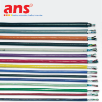
3. 150-Meter Heavy-Duty Control Cable: Heavy-duty polyurethane outer jacket encasing copper conductors and a central Kevlar strain relief member to ensure zero elongation under high tension. Swaged brass cable markers or precision laser graduations are placed at exact 0.5-meter intervals for precise vertical positioning.
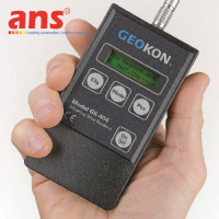
4. Ruggedized Field PC Readout: Military-grade handheld computer conforming to MIL-STD-810G and IP67 waterproof standards, with sunlight-viewable color display. Ships with GEOKON dedicated data acquisition software, providing automated check-sum validation, audible error alerting, and instantaneous on-screen deflection plots.
5. Model GK-604D-3 Cable Pulley Assembly: Clamps directly over standard casing collars (48 mm to 89 mm internal diameter). Serves as a low-friction cable guide and provides a precise mechanical index stop for cable markers during incremental profiling.
Key Engineering Features & Operational Advantages:
- Exceptional System Accuracy (Total System Accuracy ±3 mm per 30m depth): Downhole 24-bit digitization and advanced algorithmic filtering yield a repeatability of ±1 mm per 30m, enabling detection of subtle sub-millimeter shear planes long before catastrophic ground failure occurs.
- Onboard Spiral Survey Correction: In deep 150-meter boreholes, casing joints can experience rotational twist during grouting. The probe's integrated digital compass records groove twist angle simultaneously, correcting the raw inclination datasets to generate true geospatial coordinates.
- Hands-Free Wireless Operation: Wireless Bluetooth transmission allows field operators to secure the Field PC in a harness or tripod and utilize both hands to manage cable lowering and positioning, speeding up profiling cycles by up to 50% while preventing accidental equipment drops.
- Extreme Downhole Environmental Durability: The probe features a 2,000g shock survival rating and laser-welded hermetic sealing rated for immersion under hundreds of meters of hydrostatic water pressure.
Target Industrial Sectors & Applications:
- Civil Infrastructure & Deep Foundations: Lateral displacement monitoring of diaphragm walls, contiguous bored piles, and sheet piling during deep excavation for skyscrapers and multi-tier basements.
- Urban Metro & Tunneling Projects: Settlement and lateral ground deformation tracking adjacent to Earth Pressure Balance (EPB) / Slurry Tunnel Boring Machines (TBM) and underground metro stations.
- Hydroelectric Dams & Water Reservoirs: Profiling internal core and slope deformation across rockfill, earthfill, and concrete gravity dams.
- Highways, Railways & Slope Hazard Mitigation: Real-time instability tracking across unstable geological slopes, active landslides, and bridge abutments.
- Open-Pit Mining & Tailings Facilities: Long-term slope stability tracking along highwall mining benches and perimeter tailings dam embankments.
• Manufacturer: GEOKON (GEOKON, INC.)
• Country of Origin: 100% USA (Made in USA)
• Product Line: GK-604D Series Digital MEMS Inclinometer Systems
• Turnkey System Model Code: GK-604D-150M
• Order Unit: Piece / Complete System (Unit: pc)
• DIGITAL INCLINOMETER PROBE (MODEL 6100D):
- Sensor Technology: Two MEMS accelerometers mounted orthogonally (A and B axes)
- Standard Calibrated Measuring Range: ±30° from vertical (Operable measuring range up to ±90°)
- Internal Probe Digitization: 24-bit resolution A/D converter
- System Resolution: ±0.025 mm / 500 mm (±0.0001 ft / 2 ft)
- Sensor Measuring Accuracy: ±0.05% Full Scale (F.S.)
- Linearity: ±0.02% F.S. (up to ±10°)
- System Repeatability: ±1 mm per 30 meters depth (±0.05 in per 100 ft)
- Total System Accuracy: ±3 mm per 30 meters depth (±0.125 in per 100 ft)
- Probe Wheelbase: 0.5 meters standard (1.0 m and 2 ft wheelbases optional)
- Probe Physical Dimensions: 700 mm length x 25 mm diameter (cable connector adds 150 mm)
- Compatible Inclinometer Casing Size: 48 to 89 mm internal diameter (1.9 to 3.5 inches)
- Probe Metallurgy: Corrosion-resistant passivated stainless steel, hermetically sealed
- Mechanical Shock Survival: 2000 g
- Digital Compass Sensor: Anisotropic Magneto-resistive sensor, 12-bit resolution (±0.1°), ±2° compass accuracy for casing spiral surveys
- Probe Operating Temperature: -30°C to +85°C (-22°F to +185°F)
• CONTROL CABLE & BLUETOOTH CABLE REEL (MODEL GK-604D-2):
- Control Cable Length: 150 meters (150M configuration)
- Cable Architecture: Polyurethane jacket, central Kevlar strain member, zero-stretch construction
- Depth Markers: Swaged mechanical brass markers / precision graduations at 0.5-meter intervals
- Wireless Telemetry: Integrated Class 1 Bluetooth transceiver (Operating range 15 to 20 meters)
- Power Supply: Internal rechargeable Li-ion battery (7.4 V, 2600 mAh)
- Battery Operating Life: > 40 hours continuous profiling operation per charge
- Reel Environmental Operating Range: -30°C to +50°C
• FIELD PC READOUT SPECIFICATIONS:
- Architecture: Ultra-rugged Android-based or Windows Mobile industrial handheld computer
- Ingress Protection: IP67 waterproof and dustproof
- Durability Rating: MIL-STD-810G military drop-test certified (Survives 1.22 m drops to concrete)
- Optical Display: High-contrast, sunlight-readable color display with LED backlight
- Field Software: GEOKON GK-604D | aos data acquisition software (automated check-sums, live deflection plotting)
• CABLE PULLEY ASSEMBLY (MODEL GK-604D-3):
- Casing Interface: Clamping collar mechanism fitting standard 48 to 89 mm casing rims
- Functionality: Aligns cable over casing centerline, protects jacket, provides precision indexing stop for cable markers
• QUALITY & METROLOGY CERTIFICATION:
- Factory Calibration: NIST-traceable calibration certificate included, CE marked, ISO 9001 certified.